(CNN) – This week will be draining in a literal sense, due to rapid snowmelt. A great thaw is set to begin, which will bring the potential for flooding across at least 10 states.
From the West Coast to the Great Lakes, concern is growing about the significant warmup forecast this week and what impact it will have on the near-record snowpack for many regions.
“Between 5,000 feet and 7,000 feet snowpack is currently near to above record levels, with 8 to 15 inches of water contained within this snow,” the National Weather Service office in Billings explained.
Record highs are possible across the Northern Plains and Midwest this week, as temperatures climb into the 60s and 70s.
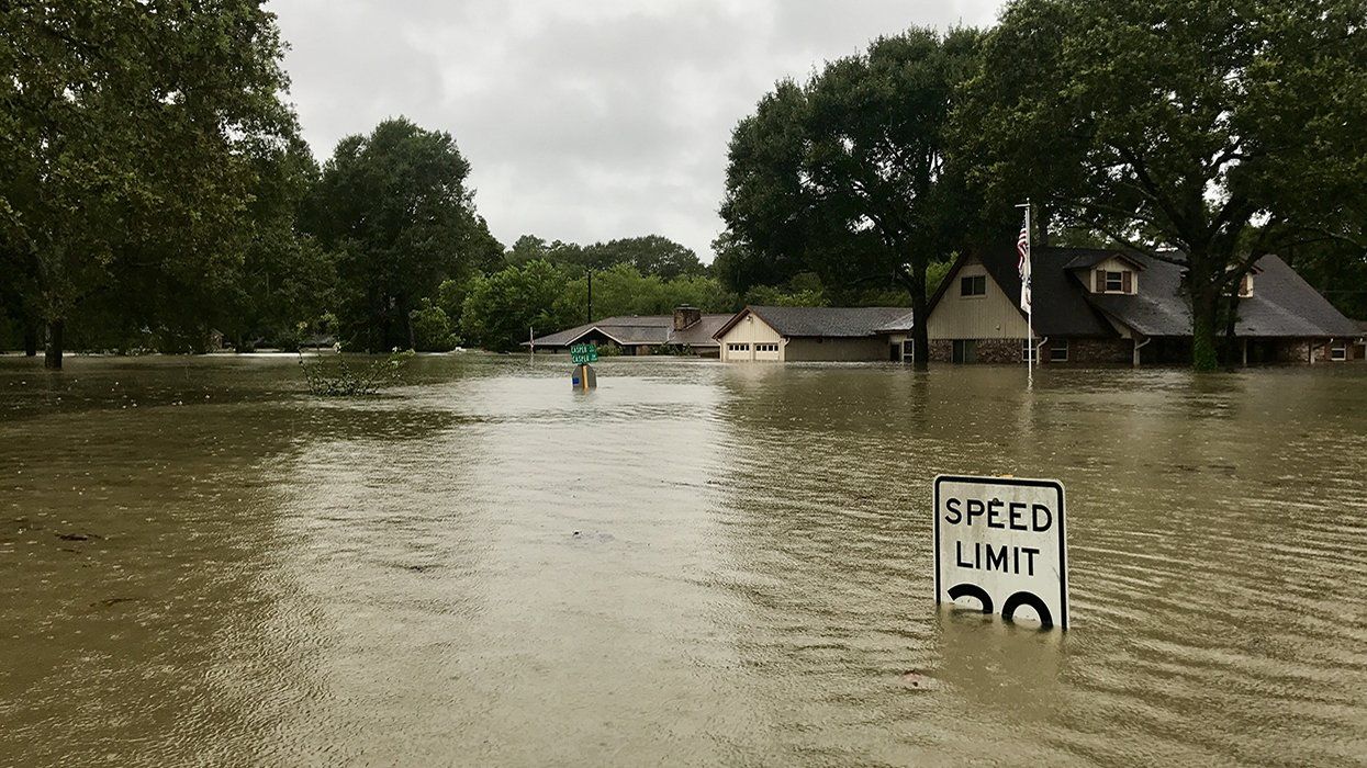
The sudden warmth combined with heavy rain from an approaching cold front could lead to rapid snowmelt, causing rivers and creeks to flood quickly; something forecasters have been expecting with this year's blockbuster winter snowpack.
“Minneapolis had their third-snowiest winter on record, so a lot of it was sitting around waiting to melt,” Eric Ahasic, a weather service meteorologist in Twin Cities, said. “We didn’t really add a ton of heavy rain on top of the snowpack while that snow was melting, so that kind of allowed it to progress fairly orderly, but we’re going to have some minor flooding in a lot of rivers.”
He explained the perfect ingredients will exist this week for a rapid melt: warm temperatures, humid air, windy conditions and a strong sun angle.
Ahasic fears areas to his north will have a much more difficult time with all this melting snow. North Dakota and Minnesota could see more significant flooding where the rivers flow to the north.
“As that water flows into the Red River, and then flows north up into Canada, it’s going to run into colder weather and even some ice farther north,” Ahasic explained. “That’s why you usually get some really bad flooding up across that part of the United States and Canada, because the water that's flowing is running into usually some sort of ice blockage.”
The blockages are often referred to as ice jams, which happen when huge chunks of ice clump together and block the flow of the river, which many times results in rapid flooding.
In portions of the Northern Plains, temperatures could climb to 80 degrees this week, possibly setting records. Any snow left on the ground will melt quickly with temperatures running at least 15 degrees above normal.
“With the ground mainly frozen in the foothills, this water will not be able to soak in and will run off,” the weather service in Billings said. “Water flowing downhill and accumulating in low-lying areas may result in localized flooding.”
The weather service urges people to stay up to date with the flooding situation over the next few weeks, in case any rivers begin to rapidly rise.
In portions of the southern Sierra, the rate of melting snow will also begin to rapidly increase this week, causing rivers to rise and run more swiftly.
The weather service warns people to stay vigilant in the lower elevations and campsites, because of the potential for flash flooding.
“Due to their swift currents and very cold-water temperatures, creeks and streams pose life-threatening dangers,” the weather service office in Las Vegas warned.
While the snow is beginning to melt more quickly this week, it will be something to follow for the next several weeks and even months.
The-CNN-Wire
™ & © 2023 Cable News Network, Inc., a Warner Bros. Discovery Company. All rights reserved.