News
Nationwide Storm to Bring Blizzard Conditions and Tornadoes

Dreams of a white Christmas? More like travel nightmares.
December 12 2022 5:30 PM EST
December 12 2022 1:31 AM EST
By continuing to use our site, you agree to our Private Policy and Terms of Use.

Dreams of a white Christmas? More like travel nightmares.
(CNN) – A large winter storm slammed into the western US over the weekend, blanketing mountain areas with heavy snow, and is now set to traverse the nation, threatening dangerous blizzard conditions, strong tornadoes, and flooding this week.
“This winter storm is a true coast-to-coast, top-to-bottom impact that will be felt by every person in the country at some point this week,” CNN Meteorologist Brandon Miller said.
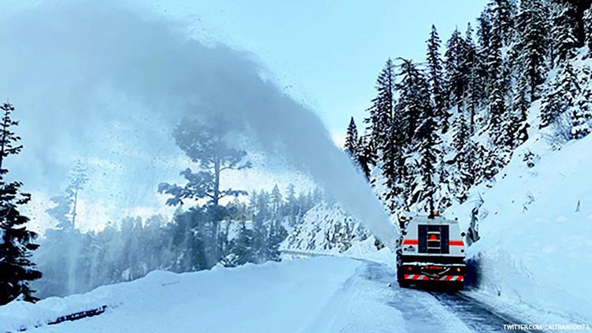
The storm already brought avalanche warnings to parts of the West, shutting down major highways as conditions became icy.
More than 10 million people in over a dozen states are under some level of winter weather alert as the powerful storm moves across the county, bringing with it a multiday severe storm threat.
Blinding blizzard conditions
The storm will strengthen as it travels eastward, bringing snow to the Rockies tonight, where a foot of snow is expected before the system strengthens even more.
The Upper Midwest, and northern and central Plains, will get hit the hardest Monday night into Tuesday as widespread heavy snow falls.
“Snow accumulations through Tuesday morning will generally range between 6 to 12 inches, centered on the Northern High Plains,” the weather prediction center said. “The highest snow totals are currently forecast for western South Dakota and northwestern Nebraska, where upwards of 18 to 24 inches is possible.”
Meanwhile, a widespread area from eastern Wyoming and Colorado to western South Dakota and Nebraska will also have winds gusts as high as 60 mph. Heavy snowfall and strong winds will set the stage for a blizzard, leading to whiteout conditions and impossible travel.
Blizzard conditions are when there are sustained winds of 35 mph or higher and visibility below a quarter mile for at least three consecutive hours.
Winter storm alerts stretch from the Canadian border to the Mexican border, and blizzard warnings extend from just west of Denver into the Dakotas.
“All preparations for this storm should be well underway and completed sooner rather than later,” the National Weather Service office in Rapid City said.
Some locales inside the blizzard warning areas could pick up as much as 20 inches of snow. The winds could be strong enough to knock down tree limbs and cause power outages, and the harsh conditions could be deadly for anyone outdoors.
“The cold wind chills, as low as 20 below zero, could cause frostbite on exposed skin in as little as 30 minutes,” the weather service office in Cheyenne, Wyoming said.
Further east, ice warnings blanket eastern North Dakota, where nearly half an inch of ice could accumulate. If it materializes, power outages are certain, and travel will be impossible.
Icing is also possible across southwestern Minnesota and western Iowa, where as much as a tenth of an inch of ice could develop.
Multiday severe storm threat
While the storm brings whiteout conditions to the North, the southern section of the storm will have the potential to bring late-season tornadoes along with strong thunderstorms.
On Monday evening, storms will fire up across western Kansas, as well as across portions of Texas and Oklahoma. The Storm Prediction Center is expecting storms to rapidly develop tonight, after dark.
A Level 2 of 5 risk of severe weather has been issued for the area, including Oklahoma City and Norman in Oklahoma, as well as Colby and Garden City in Kansas, and Wichita Falls in Texas.
“Occasional damaging winds, isolated large hail, and a couple of tornadoes will be possible tonight,” the Storm Prediction Center said.
As the storm system strengthens and pushes eastward on Tuesday, the possibility of damaging winds, hail, flash flooding, and even strong tornadoes will be a concern for portions of the Deep South, especially central Louisiana and eastern Texas.
“All modes of severe will be possible with damaging winds, hail and some more late fall tornadoes,” the weather service office in Shreveport said.
Shreveport, Monroe, and Alexandria in Louisiana are in a Level 3 of 5 risk for severe weather. Dallas, Fort Worth, and New Orleans are under a Level 2 risk.
“A couple of strong tornadoes will be possible, especially with any isolated storms which can develop just ahead of the main convective band,” the Storm Prediction Center said.
By Wednesday, the storms are not expected to be quite as intense, but could still be strong along the Gulf Coast. New Orleans, Mobile, and Tallahassee are all under a Level 2 of 5 risk of severe weather, as the potential for tornadoes will still exist.
Very heavy rain will also be of concern as several inches of rain could fall in a short amount of time within some of the heaviest downpours.
There is a Level 2 of 4 risk of excessive rainfall focused across the Lower Mississippi River Valley as rainfall amounts could top 4 inches, leading to isolated pockets of flash flooding.
The area has been starving for rain as the Mississippi River has seen some of the lowest water levels on record this fall. The rain this week could actually help the gauge near Memphis get above low water stage for the first time since mid-August. The slight bump in water level is only expected to be temporary, but it’s a positive sign moving forward.
‘It looks a lot like Christmas out here’
The storm already made for icy and dangerous conditions on key roadways, with authorities on Saturday closing down a long stretch of Interstate 80, from Colfax in Northern California to Stateline, Nevada, due to “blowing snow & near-zero visibility,” Caltrans, the state transportation agency, said on Twitter.
In the Sierra Nevada, snowpack totals are already above average, according to the National Weather Service in Reno.
“The snowpack is about 225 percent of normal, so it’s more than twice what we’d be expecting this time in December,” said Mark Deutschendorf, forecaster at the National Weather Service office in Reno.
The Tahoe Basin and the Eastern Sierra are seeing snowfall totals which are typically recorded in January.
The storm blanketed some mountain areas of drought-parched California with thick snow, including Soda Springs in the northern part of the state, which received 60 inches of snow in just 48 hours.
“It looks a lot like Christmas out here,” Deutschendorf said. “It didn’t come with a lot of wind, and it stuck to everything. It’s like a picture postcard.”
While he noted the snow totals so far are impressive, Deutschendorf said he is “cautiously optimistic” about this precipitation putting a big dent in the state’s drought.
“We had a similar run of storms last year. We had a nice head start, and then January through March were incredibly dry,” Deutschendorf explained.
In California over the weekend, 48 inches of snow fell in Twin Bridges in a 48-hour period, 46 inches fell in Tahoe-Donner, 45 inches in Donner Peak, and 44 inches at Palsades Tahoe Ski Base.
“We’re Buried,” the Palisades Tahoe Ski Resort wrote on its website Sunday, sharing photos of thick snow covering the ski resort in Olympic Valley, California.
“This is definitely a storm to remember. We’ve now received 7.5 feet of snow since December 1st. Plus, in just 24 hours from Saturday morning to Sunday morning, we received more than 35 inches of snow — the 6th largest snowfall total in 24 hours that we have on record,” resort operators wrote.
The-CNN-Wire
™ & © 2022 Cable News Network, Inc., a Warner Bros. Discovery Company. All rights reserved.
Want more breaking equality news & trending entertainment stories?
Check out our NEW 24/7 streaming service: the Advocate Channel!
Download the Advocate Channel App for your mobile phone and your favorite streaming device!