


News
Historic Snowstorm Pummels Western New York
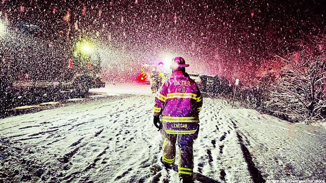
Life-threatening conditions as 4 to 5 feet of snow expected in Buffalo.
November 18 2022 12:00 PM EST
By continuing to use our site, you agree to our Privacy Policy and Terms of Use.
Life-threatening conditions as 4 to 5 feet of snow expected in Buffalo.
(CNN) – Heavy snowfall is pounding parts of western New York state as a potentially historic storm that’s already halted traffic on major roadways threatens to topple trees, damage property, and knock out power as temperatures plunge.
“The snowfall will produce near zero visibility, difficult to impossible travel, damage to infrastructure, and paralyze the hardest-hit communities,” the National Weather Service said Thursday. “Very cold air will accompany this event, with temperatures 20 degrees below normal forecast by the weekend.”
Three feet of snow had already fallen by Friday morning in Orchard Park, home of the NFL’s Buffalo Bills.
“I want to be very clear: This is not your normal snowfall in the city of Buffalo or in the region,” Buffalo Mayor Byron Brown said Friday as 4 to 5 feet of snow was forecast. “This is a snowstorm with potentially deadly consequences if people do not do the right thing.”
About 6 million people in five Great Lakes states – from Michigan to New York – are under snow alerts Friday, CNN Meteorologist Haley Brink said. Snow produced through lake-effect will continue through Sunday in areas downwind of the Great Lakes, according to the National Weather Service.
Friday morning, the heaviest bands of snow were off Lake Erie and Lake Ontario, bringing snowfall rates of 2 inches per hour to cities in and around Buffalo and Watertown in New York.
As the region braces for more:
• Commercial traffic has been banned on some roads, though some bans were replaced by travel advisories Friday morning.
• Flights have been canceled at the Buffalo airport, which already got more than a foot of snow.
• The NFL moved Sunday’s Bills game against the Cleveland Browns to Detroit.
• Parts of Oswego County near Lake Ontario received 2 feet of snow by Thursday evening.
• Hamburg, around 15 miles south of Buffalo, had almost 34 inches by 8 a.m.
• Buffalo public schools are closed Friday. So are Erie County services.
• Places east of Lakes Erie and Ontario could get 3 inches or more of snow per hour, with occasional lightning and gusty winds.
Imploring residents to take caution this weekend, New York Gov. Kathy Hochul described the storm as a “major, major” snowfall event that could be as life-threatening as the November 2014 snowstorm that claimed the lives of 20 people in the Buffalo region.
Hochul declared a state of emergency for 11 counties.
“This is a super-heavy storm,” Brown told CNN. “Right now, most of the city is in good shape – south Buffalo getting hit very hard. We anticipate that the rest of the city could get hit as hard” later in the day.
The mayor urged people to “stay vigilant” and stay home, and the city reinstated a travel ban.
“We’re ready for what comes,” Brown said, praising state, county, and various cities’ leaders for cooperation. “We had some time to prepare and plan for this storm.”
Commercial traffic was banned Thursday afternoon on about 130 miles of the New York State Thruway (Interstate 90) in the Rochester and Buffalo area to the Pennsylvania border, Hochul’s office said. Other parts of major interstates – including 90, 290, and 990 – were also shut down.
Further, officials in New York’s Erie County – which includes Buffalo – also declared a state of emergency and banned driving beginning Thursday night.
“The lake effect snow from (the storm) is very heavy and may cause tree branches to fall and damage vehicles, property, or powerlines. Watch where you park, and be aware of your surroundings if going outside,” Erie County officials wrote online.
The storm’s most intense snow is expected to lash the Buffalo area, where more than 4 feet could pile, making for a forecast not seen in more than 20 years. The city’s highest three-day snowfall is 56.1 inches, which occurred in December 2001, CNN Meteorologist Brandon Miller said.
Indeed, given the rate of snowfall, Buffalo may see a month’s worth of snow in only a few hours. That could make this month the snowiest November since 2000, when 45.6 inches in total fell in the city during the entire month, Miller added.
Already, residents of Williamstown in Oswego County near Lake Ontario saw 24 inches of snow as of Thursday evening, according to the weather service. In neighboring Oneida County, some spots were blanketed with 14 inches of snow in the 24 hours before Thursday evening, per the weather service.
What to expect this weekend
Friday alone could bring more than 2 feet of snow, which would make it one of the top three snowiest days on record in Buffalo, according to Miller.
“Heavy lake effect snow off Lake Erie with 2 to 3 inches per hour snowfall rates will continue to result in extremely difficult travel this evening for the Buffalo Metro area east to Batavia, and also in Oswego County off Lake Ontario,” the National Weather Service in Buffalo said Thursday night.
“Additional accumulations of 2 to 3 feet of snow are expected downwind of lakes Erie and Ontario, while 8 to 12 inches are likely downwind of the other three lakes by Sunday morning,” it added Friday.
Lake-effect snow happens when very cold, windy conditions form over a relatively warm lake – meaning the lake might be 40 degrees while the air is zero degrees, Miller explained. The temperature clash creates instability, which allows for the most extreme winter weather to occur.
Other areas affected by the storm include parts of the Upper Peninsula and the western Lower Peninsula of Michigan, where gusty winds and heavy snow will also cause near zero visibility and unsafe travel conditions.
The-CNN-Wire
™ & © 2022 Cable News Network, Inc., a Warner Bros. Discovery Company. All rights reserved.