News
Bomb Cyclone Christmas Brings Snow, Strong Winds, Bitter Cold Across County
Bomb Cyclone Christmas Brings Snow, Strong Winds, Bitter Cold Across County

By continuing to use our site, you agree to our Privacy Policy and Terms of Use.
Bomb Cyclone Christmas Brings Snow, Strong Winds, Bitter Cold Across County

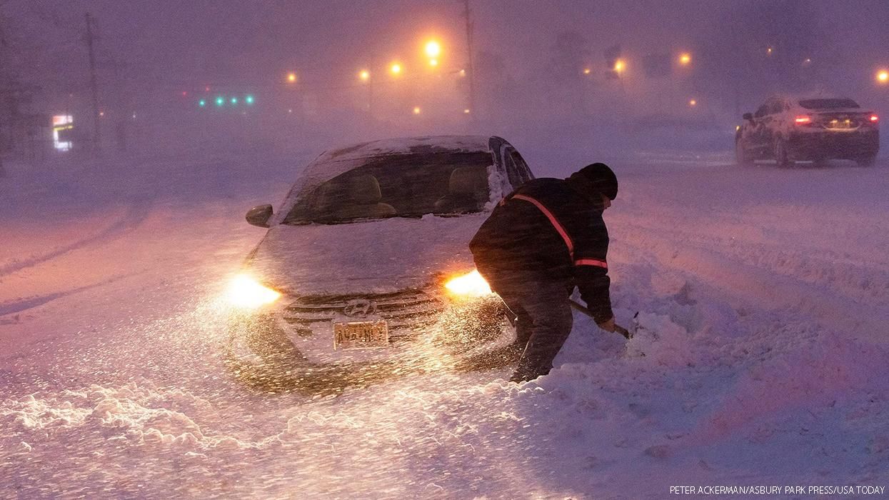
(CNN) – A sprawling storm threatens to deliver a triple whammy of heavy snow and strong winds combined with bitterly cold temperatures to much of the US on Wednesday, lasting through the end of a busy travel week.
Forecasters have been warning this week’s powerful storm could bring travel to a standstill as it hits areas from the Northwest through the Plains, the Great Lakes, and the central Appalachians before arriving in the Northeast by the end of the week, according to the National Weather Service.
Winter weather alerts are in effect for more than 70 million people from Washington state to Maryland.
The heaviest snow is expected to fall across the Cascades and into northern Idaho, northwest Montana, and western Wyoming, where more than a foot is forecast, the weather service said.
For many other areas in the northern part of the country, even if less snow falls, it is expected to be light and fluffy, and when it is blown around by 30 to 50 mph winds, it could make travel dangerous for the next two to three days.
Along with the wind, brutally low temperatures have prompted wind chill alerts from stretching from the Gulf of Mexico to the US-Canada border and from the Pacific Northwest to the Southeast. Wind chill, which indicates how the wind feels, could be as low as 50 to 70 degrees Fahrenheit below zero, according to the weather service.
“Wind chills of this magnitude can cause frostbite in less than five minutes if precautions are not taken, with hypothermia also possible from prolonged exposure to the cold,” the weather service cautioned Tuesday.
Throughout Wednesday, the storm system will move through Montana, Idaho, and Oregon by the morning. It will begin affecting cities including Minneapolis, Omaha, Denver, and Salt Lake City by the early afternoon and continue through the evening.
In anticipation of what could likely be a week of travel nightmare, United, American, Delta, Southwest, and Jet Blue have issued travel waivers for dozens of airports across the country from the South to the Northeast, because in addition to snow covering roadways, low visibility could make air travel dangerous.
“With such a large and powerful storm system impacting a majority of the nation during one of the busiest travel weeks of the year, it is imperative that travelers check the latest forecast before venturing out,” the weather service advised.
In response to the colossal storm, governors of several states across the country have taken some steps to prepare.
Colorado Gov. Jared Polis activated more than 100 National Guard members to support extreme cold weather operations across the state, according to a news release.
“Colorado is about to face extreme weather and cold temperatures and the Guard is ready to assist local communities to help keep people safe during this extreme cold weather snap,” Polis said.
North Carolina declared a state of emergency Tuesday to help with the transport of fuel and critical supplies as well as assist first responders and protect consumers from price gouging, the governor’s office said in a statement.
West Virginia is under a declared State of Preparedness, according to the governor. Missouri has also activated the state’s emergency operations plan, which frees National Guard resources to respond to the storm impact if needed.
A developing ‘bomb cyclone’
So far, snow has fallen mainly across parts of northern and central Montana, northern and central Idaho, eastern Oregon, western North Dakota, central South Dakota, and western Colorado.
The storm, which is expected to develop into a bomb cyclone, is expected to strengthen quickly as temperatures drop drastically low across most of the US by the end of the week.
For a storm to be defined as a bomb cyclone, it must drop 24 millibars (a measure of atmospheric pressure) in 24 hours.
The storms are more typically seen with winter nor’easters. But in this week’s case, the bomb cyclone is expected to occur in the Plains, where there is an extreme temperature difference between the warm and moist air ahead of the storm and the Arctic air mass moving in from Canada behind it.
The storm is expected to reach the pressure equivalent of a Category 2 hurricane as it reaches the Great Lakes, with the weather service describing the strength of the low as a "once-in-a-generation" event.
“This is a case in which snow totals may not tell the whole story. Even small snow amounts, when combined with very strong wind gusts and plummeting temperatures, can cause poor visibility and slick spots on roads. The sudden arrival of these conditions can increase the danger,” the weather service explained.
Additionally, strong winds may knock out power lines from the Midwest to the Northeast, especially in areas where heavy snow fell last week and is already weighing down tree branches.
The-CNN-Wire
™ & © 2022 Cable News Network, Inc., a Warner Bros. Discovery Company. All rights reserved.
Managing Editor at OutTraveler. Also write for Out, The Advocate, and Plus magazines.
Managing Editor at OutTraveler. Also write for Out, The Advocate, and Plus magazines.